Mississippi Weather Network severe weather outlook for Tuesday
The Mississippi Weather Network put together a Severe Weather Outlook for Tuesday in parts of Mississippi.
Check them out here to follow along with updates.
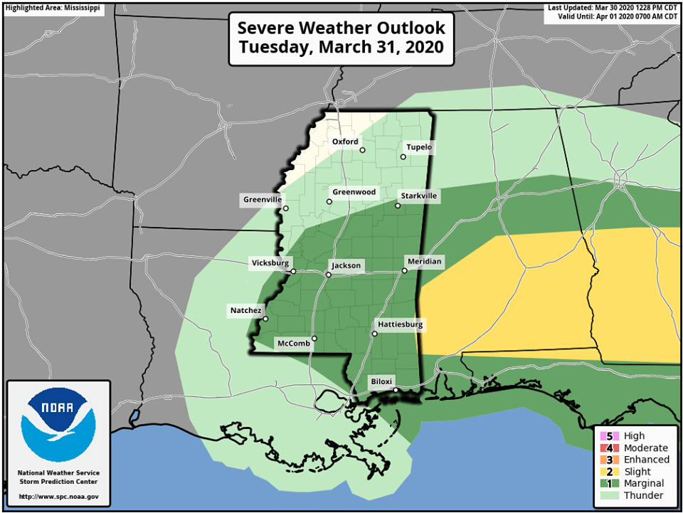
SEVERE WEATHER OUTLOOK (03/31): Mississippi Weather Network is tracking a small threat for severe weather early tomorrow morning.
Most of Central Mississippi has been placed under a marginal (level 1/5) risk zone from the NWS Storm Prediction Center, some of the newest data suggest we may see some of the eastern areas upgraded to a slight (level 2/5) risk.
Currently it is believed there is a small threat for straight-line winds, severe hail, and a tornado can not completely be ruled out.
MWN believes we should start seeing effects of this storm along the Mississippi river a little before 06:00 AM based on the newest model runs, this system will linger over into East MS until close to noon.
The MWN team is on standby ready to report on any severe weather warning they make break out during the am hours of your Tuesday, we remind you that we are YOUR source for all severe weather and general weather!