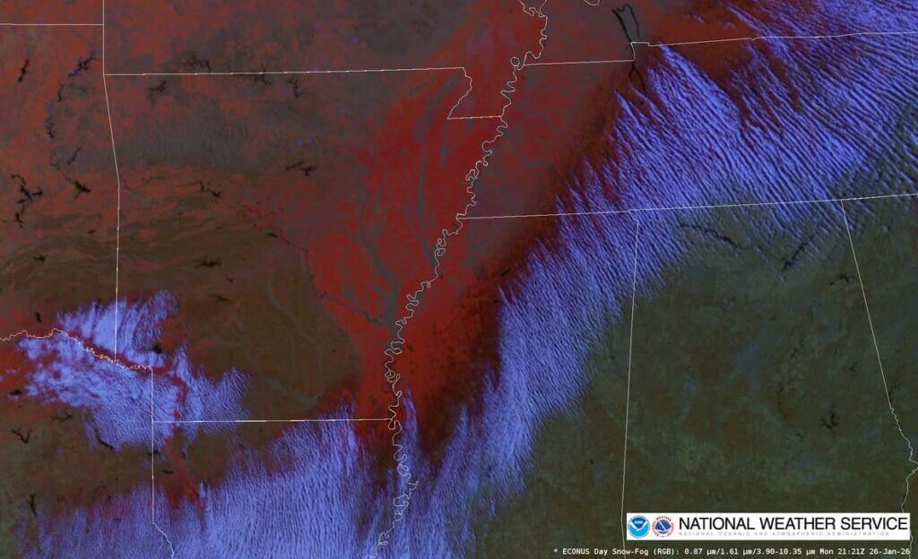
A still image from GOES Day Snow-Fog imagery captured at 21:21 UTC (3:21 p.m. CST) shows snow and ice features over northeast Mississippi and northwest Alabama. The image uses color coding to indicate different conditions: dark red for ice and light red or orange for snow, according to NOAA.
The image also displays convective cloud rolls, or “cloud streets,” which form after cold air moves off the ice pack onto warmer ground. These patterns are visible in the satellite imagery and help meteorologists analyze weather dynamics in the region.
Additional information about GOES Day-Fog imagery and cloud street formation can be found through resources provided by Colorado State University and NOAA. The links offer further details on interpreting satellite data and understanding atmospheric convection patterns.
Jon R Myers is the executive editor of Alcorn County News and the founder of the Mississippi News Group, which he started in 2013 to cover communities across North Mississippi. He also founded the Mississippi Sports Group in 2006, which grew from a single community publication into a statewide network covering high school and college athletics. He reports on local government, public safety, schools and community life in Corinth and Alcorn County, working from public meetings, agency records and interviews with the people involved. Contact him at editor@alcornnewsms.com with news tips or corrections. For a correction, include the article link and supporting source material.
Stay connected
Your community. Wherever you are.
Follow Alcorn County News on Facebook for local news from Corinth and across Alcorn County.