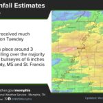
A Corinth flood advisory went out before dawn Sunday after thunderstorms dumped 1.5 to 3 inches of rain on parts of Alcorn, Prentiss, and Tishomingo counties in about three hours. The National Weather Service in Memphis issued the advisory at 4:18 a.m. and kept it in effect until 7:15 a.m., warning of minor flooding in low-lying and poor-drainage areas around Corinth and Booneville.
The heavy rain came on top of the soaking showers that moved through Northeast Mississippi on Halloween, ending a long dry spell. Forecasters say more rain is on the way, with the next round timed for Tuesday night, the evening of Election Day.
What the Corinth flood advisory covered
According to the National Weather Service, Doppler radar showed heavy rain from thunderstorms over the region early Sunday, with 1.5 to 3 inches falling since 1 a.m. The advisory covered:
All of Alcorn County
Northern Prentiss County
Northern Tishomingo County
Tippah, Union, central Benton, and northwestern Pontotoc counties
Eastern Lafayette and southeastern Marshall counties
Corinth, Booneville, and New Albany were named as places likely to see flooding. The weather service described the expected impacts as minor flooding of low spots, ditches, and streets with poor drainage.
Use caution on rural roads
Even after an advisory ends, standing water can linger on county roads and low-water crossings, especially in the hilly parts of Tishomingo and Prentiss counties. The weather service reminds drivers that the terrain has hundreds of low-water crossings that can become dangerous in heavy rain.
Do not drive through water covering a road. Turn around and find another route.
Watch for washed-out shoulders and debris on gravel roads.
Slow down on wet pavement, since visibility and traction drop during downpours.
Forecast: more rain Tuesday night into Wednesday
The Memphis forecast office expects showers to keep going Sunday morning and taper off in the afternoon, with another quarter to half inch possible in Corinth. Highs should reach the mid-60s. Monday looks drier, mostly cloudy, and warmer, with a high near 74.
The next system arrives later than earlier forecasts had suggested. Election Day itself looks mostly dry in Corinth, with only a slight chance of a shower after noon and gusty south winds up to 25 mph. Showers and thunderstorms move in Tuesday night, with 1 to 2 inches of new rain possible, and they continue into Wednesday.
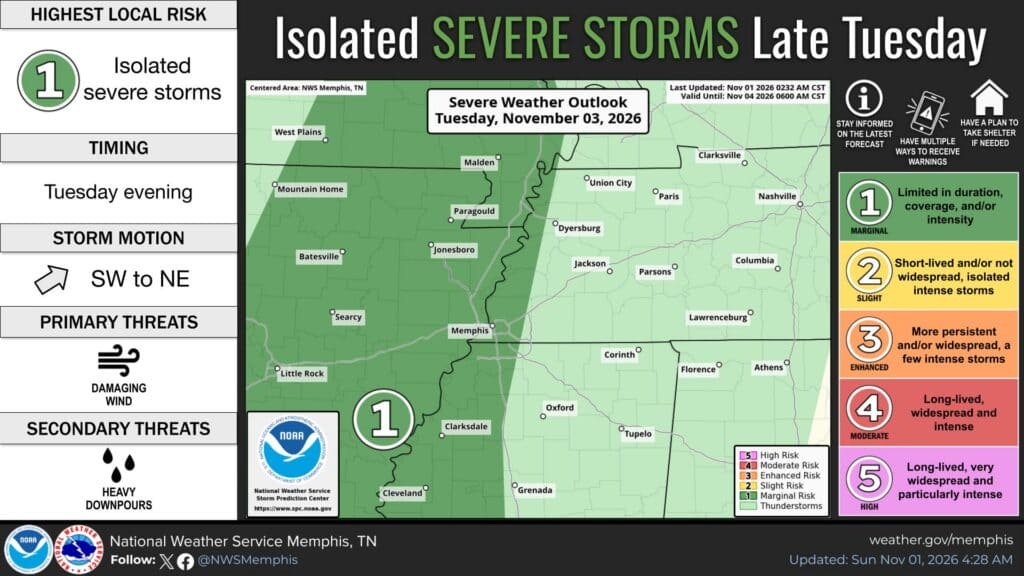
The weather service’s latest outlook puts a marginal (level 1 of 5) risk of isolated severe storms over eastern Arkansas, the Memphis area, and the Mississippi Delta late Tuesday, with damaging wind the main threat. Corinth and the rest of Northeast Mississippi are outside that risk area for now, but general thunderstorms and heavy downpours are expected. Forecasters say the setup looks more like a heavy-rain event than a severe one, with some spots possibly topping 2 inches.
Drier, cooler weather is expected to return late in the week and into next weekend, with lows dropping into the 40s.
Jon R Myers is the executive editor of Alcorn County News and the founder of the Mississippi News Group, which he started in 2013 to cover communities across North Mississippi. He also founded the Mississippi Sports Group in 2006, which grew from a single community publication into a statewide network covering high school and college athletics. He reports on local government, public safety, schools and community life in Corinth and Alcorn County, working from public meetings, agency records and interviews with the people involved. Contact him at editor@alcornnewsms.com with news tips or corrections. For a correction, include the article link and supporting source material.
Stay connected
Your community. Wherever you are.
Follow Alcorn County News on Facebook for local news from Corinth and across Alcorn County.