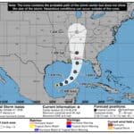
Isaias rain in Corinth fell far short of what forecasters had hoped. The storm’s remnants passed over Northeast Mississippi on Saturday, but Corinth’s Roscoe Turner Airport recorded just 0.42 inch of rain, plus a trace more after midnight. That is well below the 1 to 2.5 inches the National Weather Service in Memphis had forecast for the area in its Flood Watch.
Tupelo Regional Airport measured about half an inch. Now, with the storm gone, forecasters say sunny skies and possible record heat are returning, which will add to the stress on an area already in severe drought.
Isaias rain in Corinth: why so little?
Airport observations show that after rain moved in late Saturday morning, mostly light rain and drizzle fell through Saturday afternoon and Saturday night in Corinth. In its Sunday morning forecast discussion, the Weather Service said only light rain lingered along the Tennessee River and across Northeast Mississippi overnight before the system pulled away to the northeast.
Wind ended up causing more trouble than rain. Gusts knocked out power to hundreds of customers in Glen, Corinth, and parts of Tishomingo County on Saturday afternoon.
Near-record heat expected this week
A much drier air mass moved in Sunday, and highs are expected to climb into the low 90s. The Weather Service forecast for Corinth calls for:
Sunday: sunny, high near 83
Monday (Columbus Day): sunny, high near 90
Tuesday: sunny, high near 91
Wednesday: sunny, high near 92
Thursday: sunny, high near 91
Friday: mostly sunny, high near 83
Forecasters said those highs are 10 to 15 degrees above normal for mid-October and could tie or break daily records at Memphis, Tupelo, and other Mid-South sites. A weak disturbance Wednesday could bring a few showers to northern parts of the Mid-South, but the Weather Service said confidence in meaningful rain is low for most areas. Forecast models suggest a stronger system could bring cooler, more seasonable air by next weekend, but the timing is still uncertain.
Drought and burn ban concerns
The latest U.S. Drought Monitor map, from Oct. 6, showed all of Alcorn and Tishomingo counties in severe drought (D2) and about two-thirds of Prentiss County in the same category. Less than half an inch of rain will do little to change that.
Alcorn County’s local emergency burn ban, issued Sept. 28, is set to expire Monday, Oct. 12. As of Sunday morning, county officials had not announced whether it will be extended. With hot, dry, and breezy days ahead, residents should hold off on outdoor burning and check with the Alcorn County Fire Service before lighting any fire.
Do not burn trash or brush while drought conditions continue.
Do not toss cigarettes from vehicles, and avoid parking hot vehicles on dry grass.
Check on older neighbors and pets during the afternoon heat.
Jon R Myers is the executive editor of Alcorn County News and the founder of the Mississippi News Group, which he started in 2013 to cover communities across North Mississippi. He also founded the Mississippi Sports Group in 2006, which grew from a single community publication into a statewide network covering high school and college athletics. He reports on local government, public safety, schools and community life in Corinth and Alcorn County, working from public meetings, agency records and interviews with the people involved. Contact him at editor@alcornnewsms.com with news tips or corrections. For a correction, include the article link and supporting source material.
Stay connected
Your community. Wherever you are.
Follow Alcorn County News on Facebook for local news from Corinth and across Alcorn County.