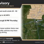
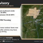
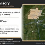
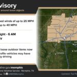
The National Weather Service in Memphis has issued a Wind Advisory for Alcorn County, Prentiss County and Tishomingo County from 4 a.m. to 8 p.m. Saturday as the remnants of Hurricane Isaias push into North Mississippi. Forecasters expect northeast winds of 15 to 25 mph with gusts up to 45 mph, on top of the Flood Watch that is already in place for the weekend.
The advisory, issued Friday at 1:33 p.m., covers a wide stretch of the Mid-South, including Corinth, Booneville and Iuka. Late Friday afternoon, the Weather Service also issued a Tropical Storm Warning for Lee, Itawamba, Monroe and Chickasaw counties, just south of Prentiss County. Our three counties are not under that warning, but they sit right next to it.
What the Wind Advisory for Alcorn County means
A Wind Advisory means sustained winds and gusts strong enough to cause problems, but below warning criteria. The Weather Service says Saturday’s gusts could:
Blow around unsecured objects such as trash cans, patio furniture and holiday or fall decorations
Bring down tree limbs, which could cause a few power outages
Make driving difficult, especially for high-profile vehicles like trucks, vans and campers
Rain timing and totals
The Flood Watch for Alcorn, Prentiss and Tishomingo counties runs from 1 a.m. Saturday until 7 a.m. Sunday. The latest NWS Memphis forecast calls for 1 to 2.5 inches of rain, with locally higher amounts up to 3.5 inches possible, mainly over Northeast Mississippi.
The Weather Service’s point forecasts as of Friday afternoon:
Tonight: Showers likely after 1 or 2 a.m., low around 60, with gusts up to 30 to 35 mph
Saturday: Rain, with showers and thunderstorms in Corinth and Iuka, some with heavy rain. High in the upper 60s, with northeast winds of 15 to 25 mph gusting to 45 mph. Rain chances are 100 percent, with 1 to 2 inches possible during the day
Saturday night: Showers tapering off before dawn, low near 60, with another quarter to three-quarters of an inch possible
Sunday: Drying out and partly sunny in Corinth, high near 79
Isaias was a hurricane with 115 mph winds near the northern Gulf Coast in the National Hurricane Center’s 4 p.m. Friday advisory. NWS Memphis expects it to weaken to a tropical storm and then a depression as it moves inland across Alabama and toward Tennessee and Kentucky by Sunday.
How to prepare tonight
NWS Memphis is urging Mid-South residents to make backup plans for Saturday’s outdoor events. Several local organizers have already adjusted, including the Cat Reman Challenge 5K in Corinth, which moved to a virtual format. Other ways to get ready:
Secure or bring inside loose outdoor items before you go to bed
Charge phones and keep flashlights handy in case limbs knock out power
Have more than one way to receive warnings, such as a weather radio, phone alerts and local broadcasts
Never drive through flooded roads. Turn around, don’t drown
Report downed lines to your power provider and stay well away from them
Alcorn County Emergency Management Director Evan Gibens posted a video update about Isaias on the agency’s Facebook page Friday, and residents can follow that page for local updates over the weekend.
Jon R Myers is the executive editor of Alcorn County News and the founder of the Mississippi News Group, which he started in 2013 to cover communities across North Mississippi. He also founded the Mississippi Sports Group in 2006, which grew from a single community publication into a statewide network covering high school and college athletics. He reports on local government, public safety, schools and community life in Corinth and Alcorn County, working from public meetings, agency records and interviews with the people involved. Contact him at editor@alcornnewsms.com with news tips or corrections. For a correction, include the article link and supporting source material.
Stay connected
Your community. Wherever you are.
Follow Alcorn County News on Facebook for local news from Corinth and across Alcorn County.