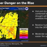
Alcorn County fire danger stays elevated this week. The National Weather Service in Memphis expects highs to climb toward 90 degrees by Thursday and Friday, with afternoon humidity staying low until a Gulf tropical system possibly brings rain to Northeast Mississippi this weekend. Alcorn County’s outdoor burn ban is still in effect through Monday, Oct. 12.
In its Tuesday morning forecast discussion, the NWS office in Memphis said highs across the Mid-South will run about 10 degrees above normal through late week under a broad ridge of high pressure. It listed elevated wildland fire danger through Friday as its top concern and urged residents to “adhere to local burn bans.”
Corinth forecast: near-90 heat and morning fog
The NWS point forecast for Corinth calls for sunny, dry days and mild nights through Friday:
Tuesday: Sunny, high near 86. Areas of fog are possible after 11 p.m., with a low around 57.
Wednesday: Patchy fog before 8 a.m., then sunny with a high near 87.
Thursday: Morning fog possible, then sunny with a high near 89.
Friday: Sunny, high near 88, with an east-northeast breeze up to 10 mph.
Saturday: 30 percent chance of showers after 7 a.m., high near 82. The chance rises to 40 percent Saturday night, when thunderstorms are possible.
Sunday: 40 percent chance of showers and thunderstorms, high near 80.
Monday: Slight chance of morning showers, mostly sunny, high near 82.
Forecasters said a warm front stalling over north Mississippi tonight could bring patchy fog to northeast Mississippi and areas near the Tennessee River. Drivers on Highway 72, Highway 45 and rural county roads should allow extra time and use low beams early Wednesday and Thursday.
Why Alcorn County fire danger remains high
The NWS said afternoon relative humidity will fall below 30 percent across much of the Mid-South, with light winds. Dry air on top of already parched vegetation lets grass and brush fires start easily and spread quickly.
The drought has been worsening. The U.S. Drought Monitor’s most recent map, valid Sept. 29 through Oct. 5, shows all of Alcorn County in severe drought (D2). It also shows severe drought over about 46 percent of Tishomingo County and about 24 percent of Prentiss County, with the rest of both counties in moderate drought (D1).
Alcorn County burn ban runs through Oct. 12
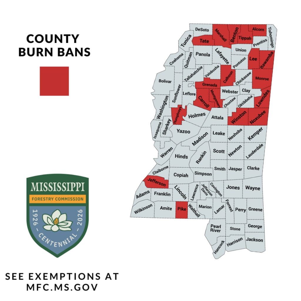
The Mississippi Forestry Commission’s burn ban table, updated Tuesday, lists Alcorn County’s ban as issued Sept. 28 and expiring Oct. 12. Under the commission’s rules, county bans expire at midnight on the listed date unless county officials lift or extend them. Nearby Tippah, Lee and Itawamba counties are also under bans on the commission’s statewide map. Prentiss and Tishomingo counties were not listed as of Tuesday.
The ban covers outdoor burning such as yard debris, leaves and brush. The commission lists a set of exemptions for each county, so anyone with a planned agricultural or prescribed burn should check the details at mfc.ms.gov or contact the Alcorn County Fire Service before striking a match. Even in Prentiss and Tishomingo counties, where no ban is in place, the NWS urges extra caution until rain arrives.
Gulf tropical system could bring weekend rain
The weekend rain chances depend on a disturbance the National Hurricane Center is tracking in the southwestern Gulf, known as Invest 92L. In its Tuesday morning outlook, the hurricane center gave the system a 90 percent chance of becoming at least a tropical depression within 48 hours. It expects the system to turn north or northeast toward the northern Gulf Coast by the end of the week.
The NHC said it is still too early to determine specific impacts, and it urged people from the Florida Panhandle to Louisiana to monitor the system. NWS Memphis said models increasingly agree on a track that would lift the system toward the Louisiana and Mississippi coast, and then north-northeast. That could bring wetting rain to the Mid-South over the weekend. A NOAA Gulfstream jet was scheduled to sample the area Tuesday, and Air Force reconnaissance was set to investigate Wednesday.
Rainfall amounts for Alcorn, Prentiss and Tishomingo counties will depend heavily on the storm’s eventual path. Residents with weekend outdoor plans should check updated forecasts later this week.
What residents can do now
Don’t burn yard debris in Alcorn County while the ban is in effect, and avoid outdoor burning across the region until rain falls.
Don’t toss cigarettes from vehicles, and keep trailer chains from dragging, since sparks can start roadside grass fires.
Don’t park vehicles on dry grass, because hot exhaust parts can ignite it.
Check on older neighbors and pets during the warm afternoons, and keep water handy.
Follow NWS Memphis and the National Hurricane Center for updates on the Gulf system.
Jon R Myers is the executive editor of Alcorn County News and the founder of the Mississippi News Group, which he started in 2013 to cover communities across North Mississippi. He also founded the Mississippi Sports Group in 2006, which grew from a single community publication into a statewide network covering high school and college athletics. He reports on local government, public safety, schools and community life in Corinth and Alcorn County, working from public meetings, agency records and interviews with the people involved. Contact him at editor@alcornnewsms.com with news tips or corrections. For a correction, include the article link and supporting source material.
Stay connected
Your community. Wherever you are.
Follow Alcorn County News on Facebook for local news from Corinth and across Alcorn County.