MEMA warns Hurricane Isaias is strengthening ahead of Friday impacts
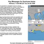
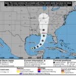
The Mississippi Emergency Management Agency said Thursday that Hurricane Isaias has strengthened into a Category 1 hurricane with maximum sustained winds of 80 mph. In the agency’s update from the National Hurricane Center, the storm was moving east-northeast at 9 mph and was expected to make landfall late Friday night or early Saturday morning.
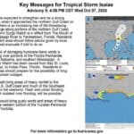
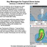
MEMA shared National Hurricane Center key messages showing a storm surge warning in effect from the Mouth of the Mississippi River to Steinhatchee, Florida. The graphic also shows a hurricane warning from Ocean Springs, Mississippi, to the Bay/Gulf County line in Florida. The update warns of heavy rainfall from Friday into the weekend and says flash flooding, urban flooding and isolated river flooding are possible.
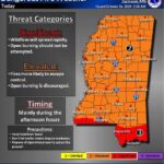
MEMA said the most severe impacts should stay concentrated along the coast, but gusty winds, heavy rain and flash flooding could reach farther inland across the forecast area. The agency said impacts are expected to begin as early as Friday morning and urged residents to complete preparations today.
The agency’s post also told residents to check emergency kits, fill vehicles with gas, check on neighbors, and secure outdoor items by removing yard debris and trimming tree branches. MEMA said people should keep following the latest forecast as the storm approaches the northern Gulf Coast.
Source: Mississippi Emergency Management Agency.
Related coverage
- MEMA urges Mississippians to prepare as Hurricane Isaias strengthens
- MEMA warns of strengthening Isaias, Gulf Coast under watch